Lot outline is approximate based on county GIS data, but may not be accurate in the event that the Parcel ID or address are not correct and/or final.
Images


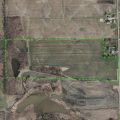


Map
Directions
From Churubusco: Northeast on SR 205 about 4 miles to CR 600S-57 (N County Line Rd.). East on CR 600S-57 about 1 mile to Fogel Rd. South on Fogel Rd about .06 mile to property, west side of road.
Description
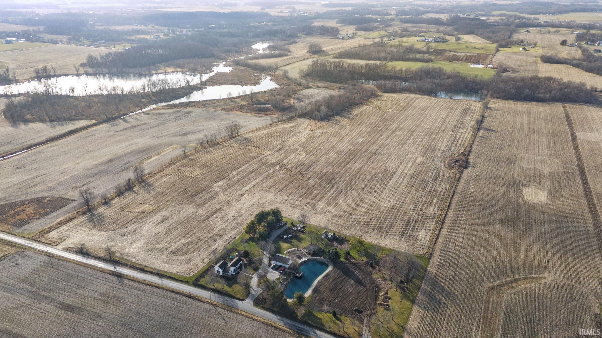
*Prepare to be transported to a setting like no other within the highly rated Carroll School District! *This expansive lot spans over 54 acres with no covenants and restrictions, offering ample space and endless opportunities for your dream home or perhaps a small high-end estate subdivision! *Embrace the peaceful ambiance with two ponds and 13 acres of woods, enhancing nature and privacy. *Walk out basement potential with the high ground overlooking White Lake that has breathtaking sunsets and no neighbors at the back. *Enjoy the best of both worlds, with suburban tranquility and urban convenience. *This property is not just a lot, it’s a canvas for your dream lifestyle. *Act now and embrace the perfect blend of space, convenience, and tranquility with your own slice of paradise!
Details
Property Details
-
MLS #:202403373
-
Price$949,900
-
Approx. Lot Size Acres54.63
-
Approx. Lot Size SqFt2,379,683
-
ClassLots And Land
-
DOM2
-
Lot Dimensions940 x 2500
-
Parcel ID#02-01-03-400-001.000-044
-
Property Sub-TypeAgricultural Land
-
StateIN
-
SubdivisionNone
-
Zip46723
Other Features
-
Water TypePond
-
Waterfront Y/NYes
Last updated: July 26 2024, 9:06 PM
Listing courtesy of: James Bradley, CENTURY 21 Bradley Realty, Inc
IDX information provided by the Indiana Regional MLS. IDX information is provided exclusively for consumers’ personal, non-commercial use and may not be used for any purpose other than to identify prospective properties consumers may be interested in purchasing. Data is deemed reliable but is not guaranteed accurate by the MLS. Listings displayed on this website may be subject to prior sale or removal from sale; availability of any listing should always be independently verified.
Calculator
Number of Payments
Monthly Payments
$